1RST TRAIL: VATHI - MEGALOCHORI - ANCIENT ACROPOLIS
DESCRIPTION: Difficulty rate: Easy (1.5 klm.)

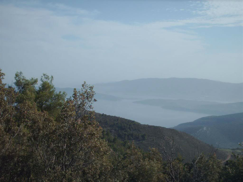
![]() From Vathi, following the asphalt road we go to Megalochori. On the way, we come across the sign that points towards "Ancient Acropolis" and turn left into a small downhill paved road.
From Vathi, following the asphalt road we go to Megalochori. On the way, we come across the sign that points towards "Ancient Acropolis" and turn left into a small downhill paved road.
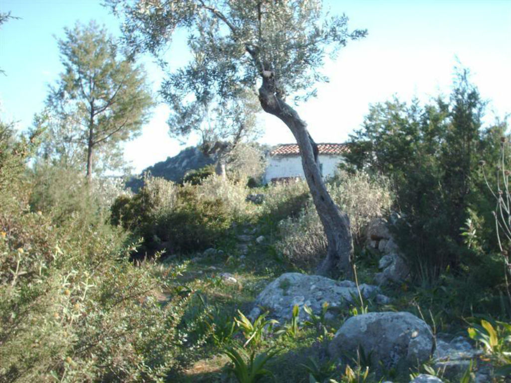
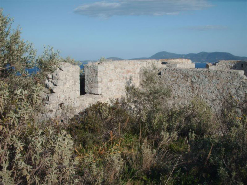
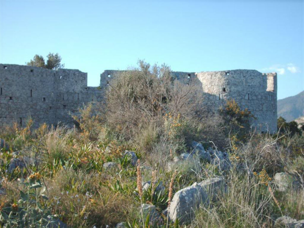
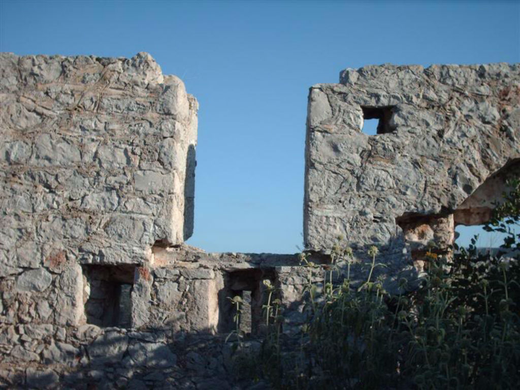
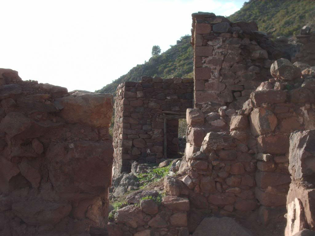
This trail leads through olive trees and fig trees in Palaiokastro, the Ancient Acropolis of Methana, with the well-preserved volcanic stone walls and the well-kept gate built during the 4th to the 3rd century BC, from the time of the Peloponnesian War. A little further down the Acropolis is the chapel of Ag. Nicholas of the 15th century.
![]() At the southernmost tip of the beach, in Vathi, were the Ancient Acropolis (Palaiokastro) is located, used to be the Ancient Town of Methana. The ground around the hill where the Acropolis used to be, has been precipitated and much of the ancient city is now below the sea. In the sea area in front of the hill there are visible underwater antiquities, including the pier of the ancient harbor. Among the immersed buildings, there are Byzantine churches. According to archaeologists, the ancient city of Methana had about 700 homes.
At the southernmost tip of the beach, in Vathi, were the Ancient Acropolis (Palaiokastro) is located, used to be the Ancient Town of Methana. The ground around the hill where the Acropolis used to be, has been precipitated and much of the ancient city is now below the sea. In the sea area in front of the hill there are visible underwater antiquities, including the pier of the ancient harbor. Among the immersed buildings, there are Byzantine churches. According to archaeologists, the ancient city of Methana had about 700 homes.
2ND TRAIL: VATHI - ANCIENT ACROPOLIS - DOVE CAVE - CASTLE OF FAVIER
DESCRIPTION: Difficulty rate: Easy
(From Vathi 1.8 klm. the Ancient Acropolis, 2.5 klm. the Dove cave and 6.2 klm. the Castle of Favier)
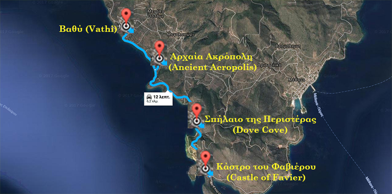
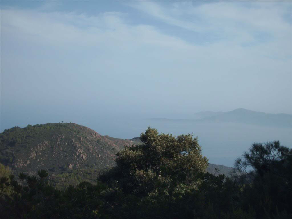
![]() The coastal road from Vathi to the Strait of Methana, just after the "Palaiokastro" tavern, turns left and leads us to the Acropolis of the Ancient Methana, with the well-preserved volcanic stone walls and the well-kept gate, which was built during the 4th 3rd c. BC, from the time of the Peloponnesian War. A little further down the Acropolis is the chapel of Ag. Nicholas of the 15th century.
The coastal road from Vathi to the Strait of Methana, just after the "Palaiokastro" tavern, turns left and leads us to the Acropolis of the Ancient Methana, with the well-preserved volcanic stone walls and the well-kept gate, which was built during the 4th 3rd c. BC, from the time of the Peloponnesian War. A little further down the Acropolis is the chapel of Ag. Nicholas of the 15th century.
At the southernmost tip of the beach, in Vathi, were the Ancient Acropolis (Palaiokastro) is located, used to be the Ancient Town of Methana. The ground around the hill where the Acropolis used to be, has been precipitated and much of the ancient city is now below the sea. In the sea area in front of the hill there are visible underwater antiquities, including the pier of the ancient harbor. Among the immersed buildings, there are Byzantine churches. According to archaeologists, the ancient city of Methana had about 700 homes.
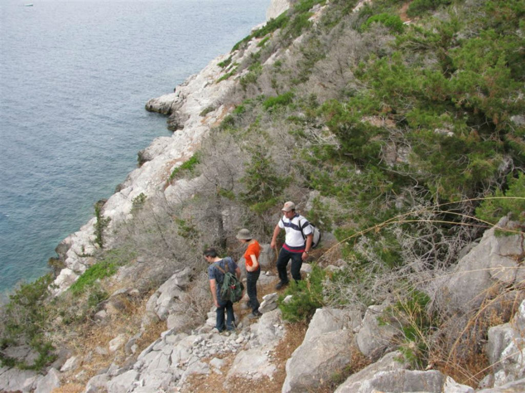
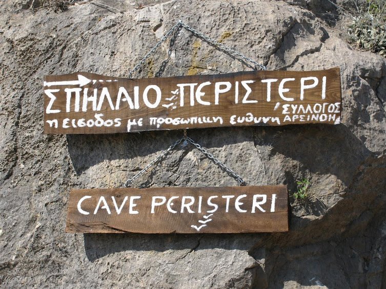
![]() The Dove Cave is located on the west coast road 2.5 km from Vathi. It was discovered in 1973 at the opening of the western coastal road, is 2.5 million years old, it is 250 meters long and consists of three chambers.
The Dove Cave is located on the west coast road 2.5 km from Vathi. It was discovered in 1973 at the opening of the western coastal road, is 2.5 million years old, it is 250 meters long and consists of three chambers.
Before the fish farming, we find on our left a sign that guides us towards the cave. The sign was placed by the Arsinoe association and warns us of the danger of approaching the cave.
We carefully climb to the rocks to the left of the road and after 30m. we reach the entrance to the cave. From there, we must carefully descend towards the cave between steep rocks to reach the first chamber of the cave, which is essentially an underground lake. From there, if you swim or use an inflatable boat, we can go further into the cave.
The second chamber is full of rocks and in the third there is water again. In the last two chambers there are impressive stalagmites in beautiful formations. It is said that the cave extends below the plateau "Throni".


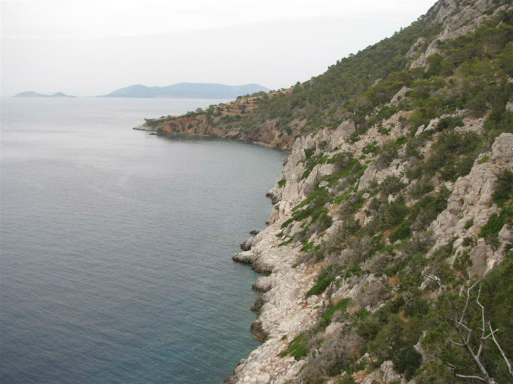
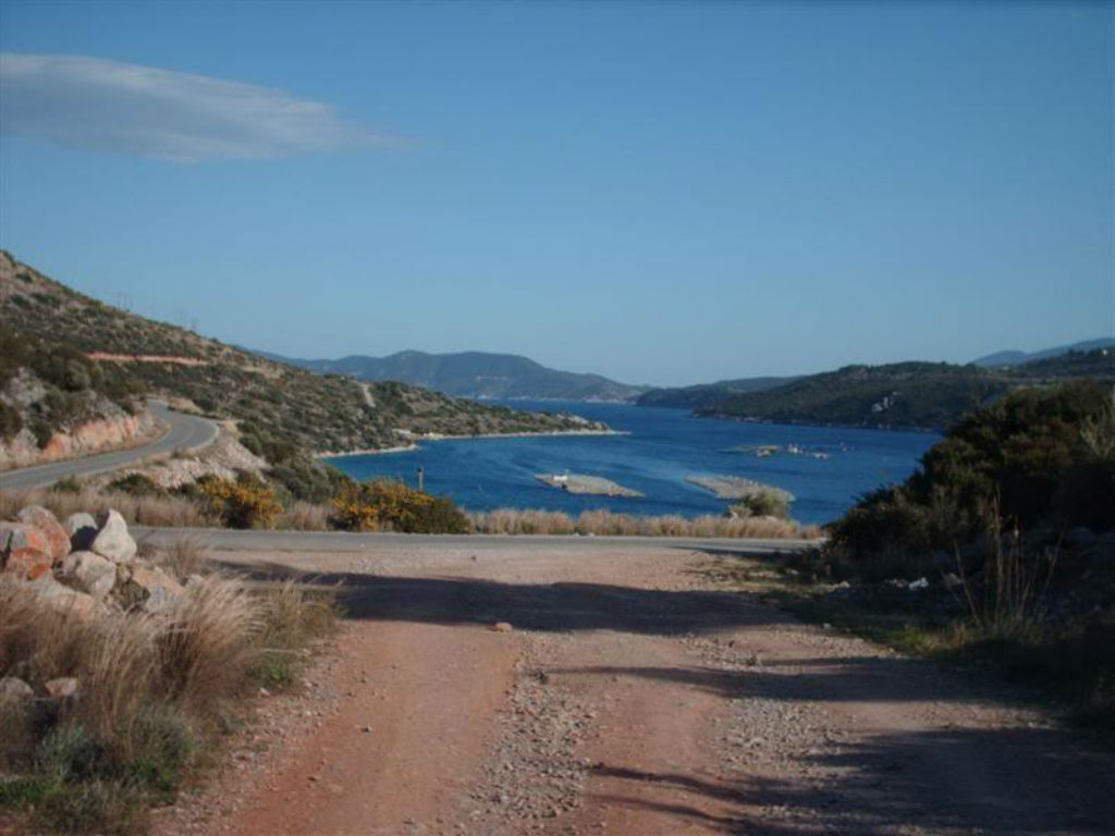
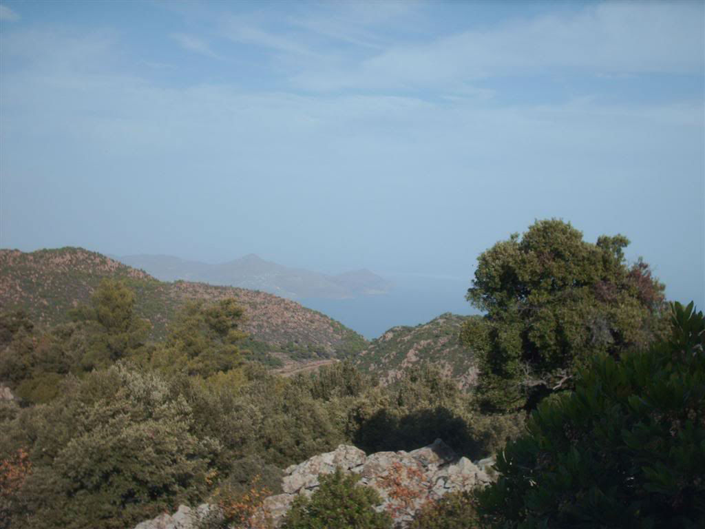
![]() Continuing along the coastal road, after about 1100 meters from the Dove cave, we meet a junction with a trail and follow the dirt road that goes to our right.
Continuing along the coastal road, after about 1100 meters from the Dove cave, we meet a junction with a trail and follow the dirt road that goes to our right.
![]() Immediately after about 10 meters starts a path to our left. It is quite distinct and the beginning is indicated by a blue mark on a stone. The path ascends smoothly, it is quite distinct and along its length you will find blue marks on the stones.
Immediately after about 10 meters starts a path to our left. It is quite distinct and the beginning is indicated by a blue mark on a stone. The path ascends smoothly, it is quite distinct and along its length you will find blue marks on the stones.
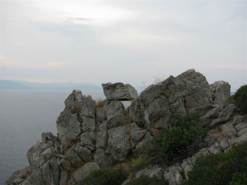
![]() On the way we meet a chapel where there is a wooden signpost. By approaching the Castle of Favier, the trail has vegetation and the label is diluted. However, the course is self-evident as the Castle already appears and you will have no problem.
On the way we meet a chapel where there is a wooden signpost. By approaching the Castle of Favier, the trail has vegetation and the label is diluted. However, the course is self-evident as the Castle already appears and you will have no problem.
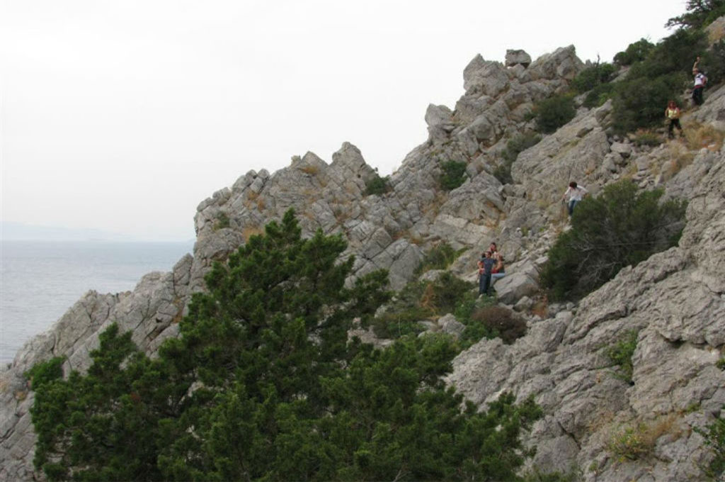
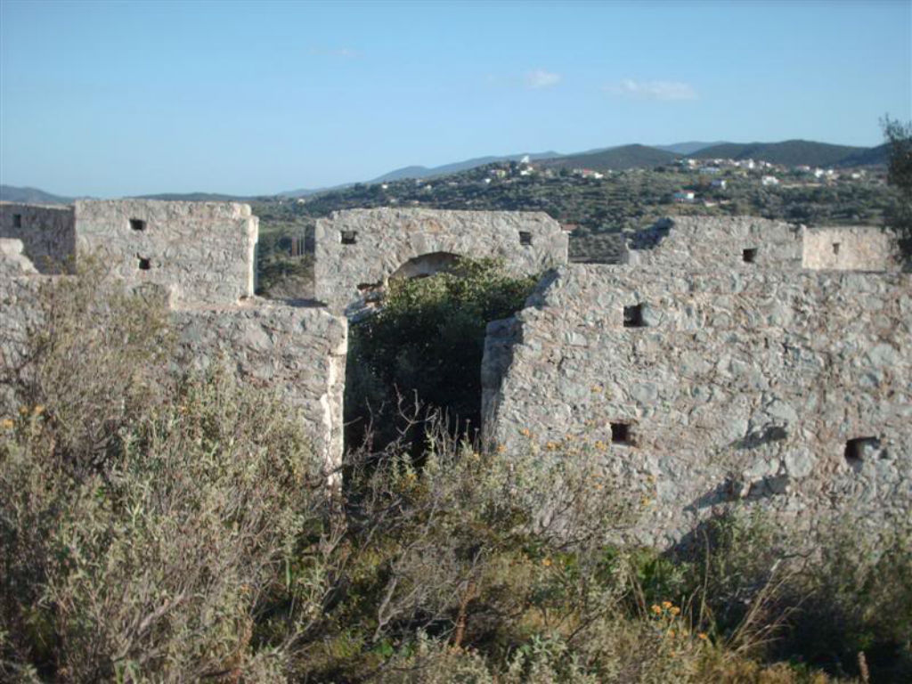
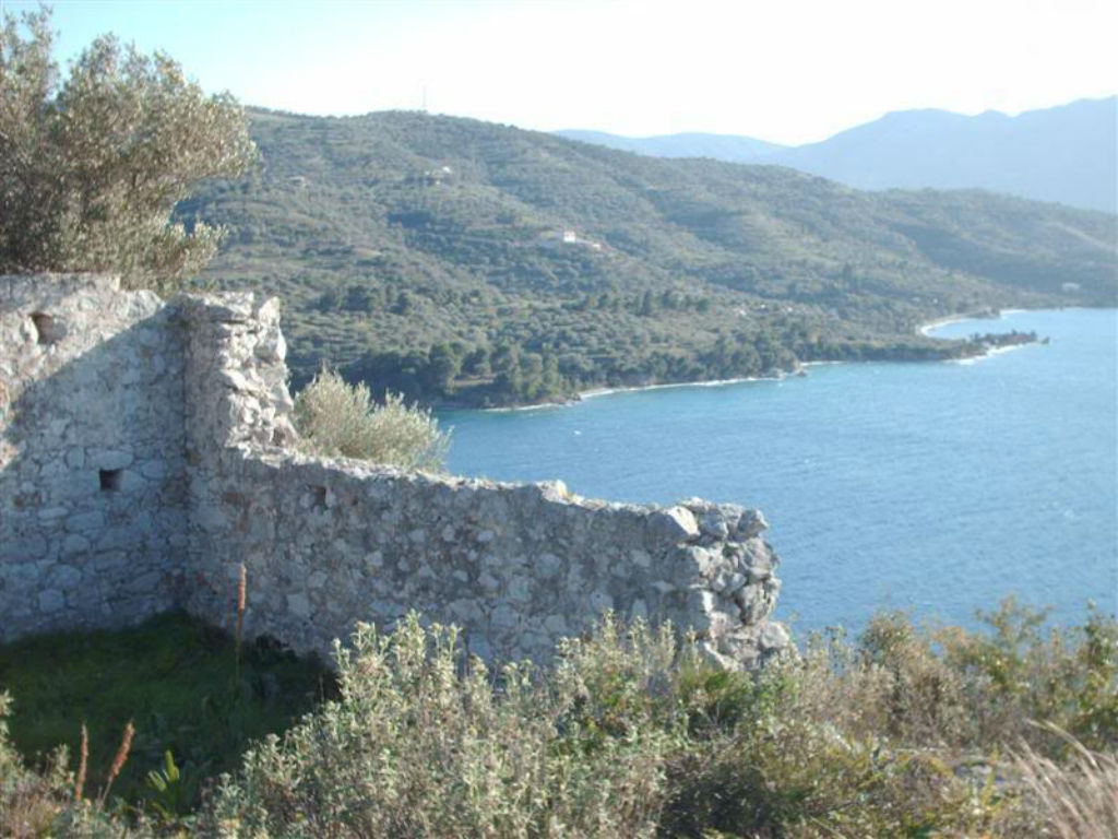
![]() Through the length of the route we find remnants of fortifications. Approaching the Castle we cross a wall and in a few meters we enter the Castle. Crossing the Castle, in front of it we find a plateau with a very nice view both towards Poros and the bay of Epidavros.
Through the length of the route we find remnants of fortifications. Approaching the Castle we cross a wall and in a few meters we enter the Castle. Crossing the Castle, in front of it we find a plateau with a very nice view both towards Poros and the bay of Epidavros.
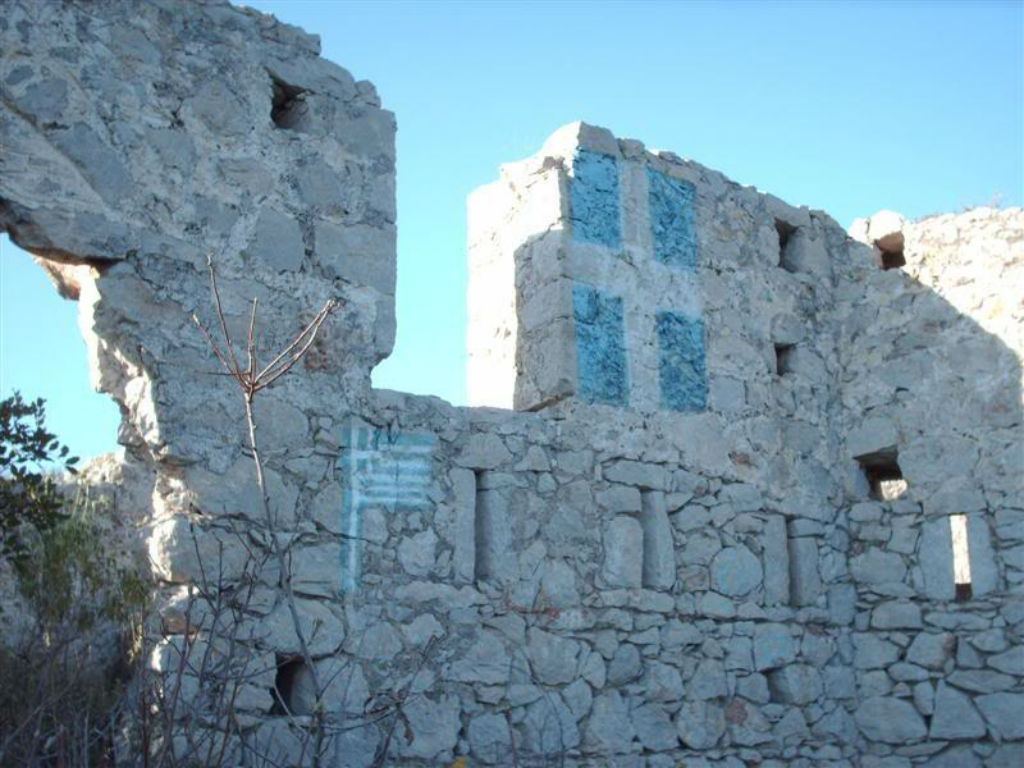
![]() The castle of Favier is one of the most impressive sights of the area, which is a listed historic monument. It is located at an altitude of about 80m above the hill of the Straits of Methana. It was built in 1826 under the command of Nikolaos Karolos Favieros, a French general, and was built on the ruins of fortifications built by the Athenians (Nikias) in the 5th century BC, in the Peloponnesian War. It is a medieval castle with four small turrets at its edges.
The castle of Favier is one of the most impressive sights of the area, which is a listed historic monument. It is located at an altitude of about 80m above the hill of the Straits of Methana. It was built in 1826 under the command of Nikolaos Karolos Favieros, a French general, and was built on the ruins of fortifications built by the Athenians (Nikias) in the 5th century BC, in the Peloponnesian War. It is a medieval castle with four small turrets at its edges.

3RD TRAIL: VATHI - MEGALOCHORI - PANAGITSA - STERNA TOU GAMPROU - KAMINI CHORA - VOLCANO
DESCRIPTION: Difficulty rate: Medium (6.8 klm.)
![]() Starting from Vathi and following the asphalt road, after 1800 meters, we reach Megalohori.
Starting from Vathi and following the asphalt road, after 1800 meters, we reach Megalohori.
![]() From the Church in Megalochori we climb the stairs and meet a cement road that leads us after a 150 meter course in the last houses of Megalohori. There we meet a stream, we turn left and walk a few tens of meters into the stream.
From the Church in Megalochori we climb the stairs and meet a cement road that leads us after a 150 meter course in the last houses of Megalohori. There we meet a stream, we turn left and walk a few tens of meters into the stream.
![]() On our right starts a built path, which in some places is wide enough and has stone stairs. Climbing the cobblestone path, at some points the ascent is steeply. Continuing we find a very well preserved chapel with a cistern and after about 300 meters we arrive after about an hour in the small church of Panagitsa, at an altitude of 550 meters.
On our right starts a built path, which in some places is wide enough and has stone stairs. Climbing the cobblestone path, at some points the ascent is steeply. Continuing we find a very well preserved chapel with a cistern and after about 300 meters we arrive after about an hour in the small church of Panagitsa, at an altitude of 550 meters.
It is a small Byzantine temple, which is in excellent condition, with unique frescoes of the 12th century, which used ancient materials (stone, millstone) for its masonry.
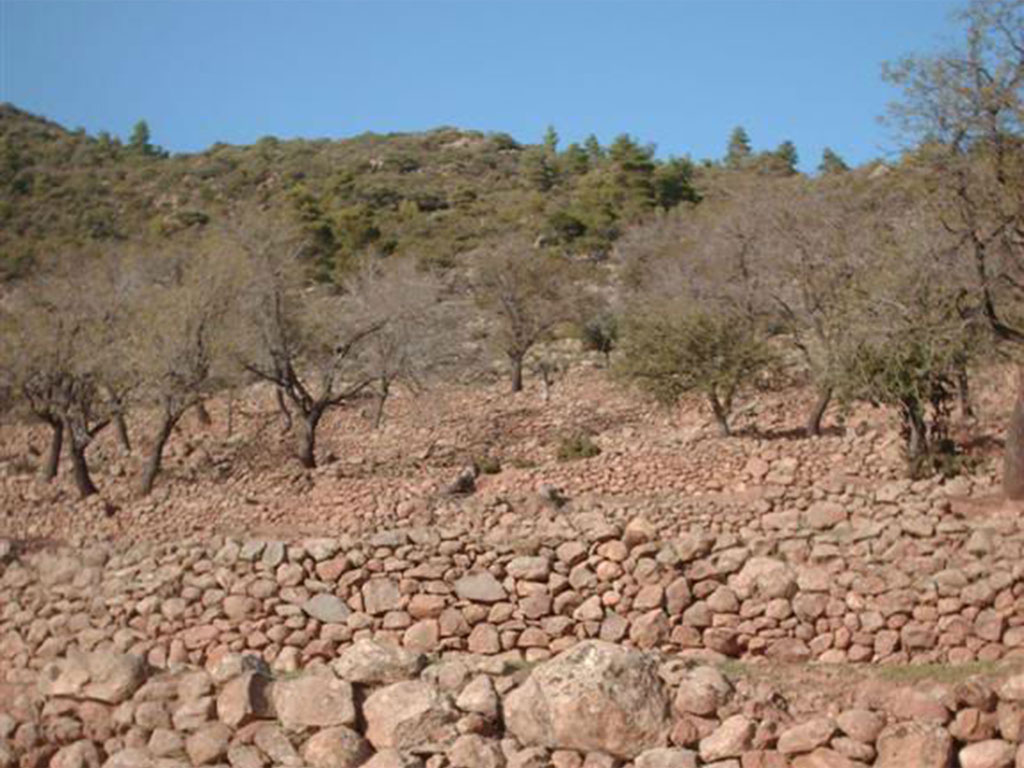
![]() 250 meters above the small church of Panagitsa we meet on our right a small farmhouse and after about 800 meters passing between terraces, we reach the abandoned settlement of Panagitsa. Almost all the houses of the settlement are completely destroyed, but many of them reveal that the settlement was inhabited since the Archaic years.
250 meters above the small church of Panagitsa we meet on our right a small farmhouse and after about 800 meters passing between terraces, we reach the abandoned settlement of Panagitsa. Almost all the houses of the settlement are completely destroyed, but many of them reveal that the settlement was inhabited since the Archaic years.
![]() From this point we can go left to the top of Helona mountain or to the right to Agios Panteleimonas.
From this point we can go left to the top of Helona mountain or to the right to Agios Panteleimonas.
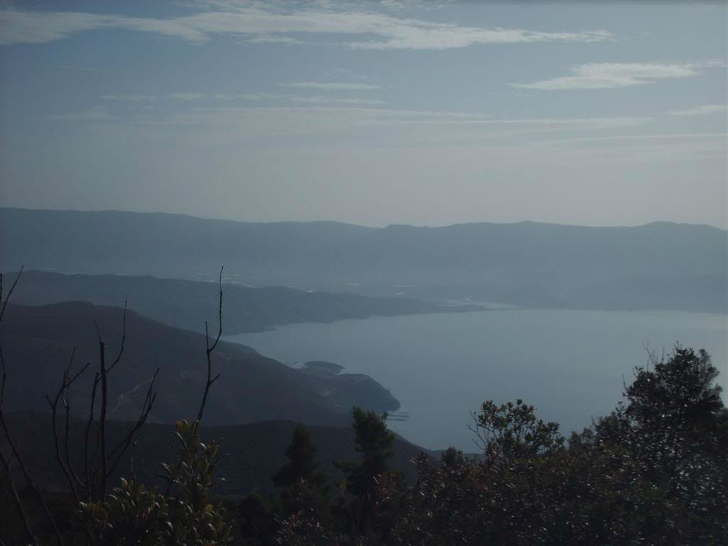
![]() The route from the village of Panagitsa to the top of Helona mountain is quite difficult and requires another one hour of uphill course. The path is marked with blue squares, a kind of old signing, and more recently small blue circles. On the way to the top of Helona mountain, we find a plateau with many wells, cisterns and ruins of ancient buildings. From here, we reach the highest point of the Methana peninsula, the top of Helona mountain, at an altitude of 740 meters. From this point we have a unique view of Methana, Poros, Galatas, Aegina and Agistri.
The route from the village of Panagitsa to the top of Helona mountain is quite difficult and requires another one hour of uphill course. The path is marked with blue squares, a kind of old signing, and more recently small blue circles. On the way to the top of Helona mountain, we find a plateau with many wells, cisterns and ruins of ancient buildings. From here, we reach the highest point of the Methana peninsula, the top of Helona mountain, at an altitude of 740 meters. From this point we have a unique view of Methana, Poros, Galatas, Aegina and Agistri.
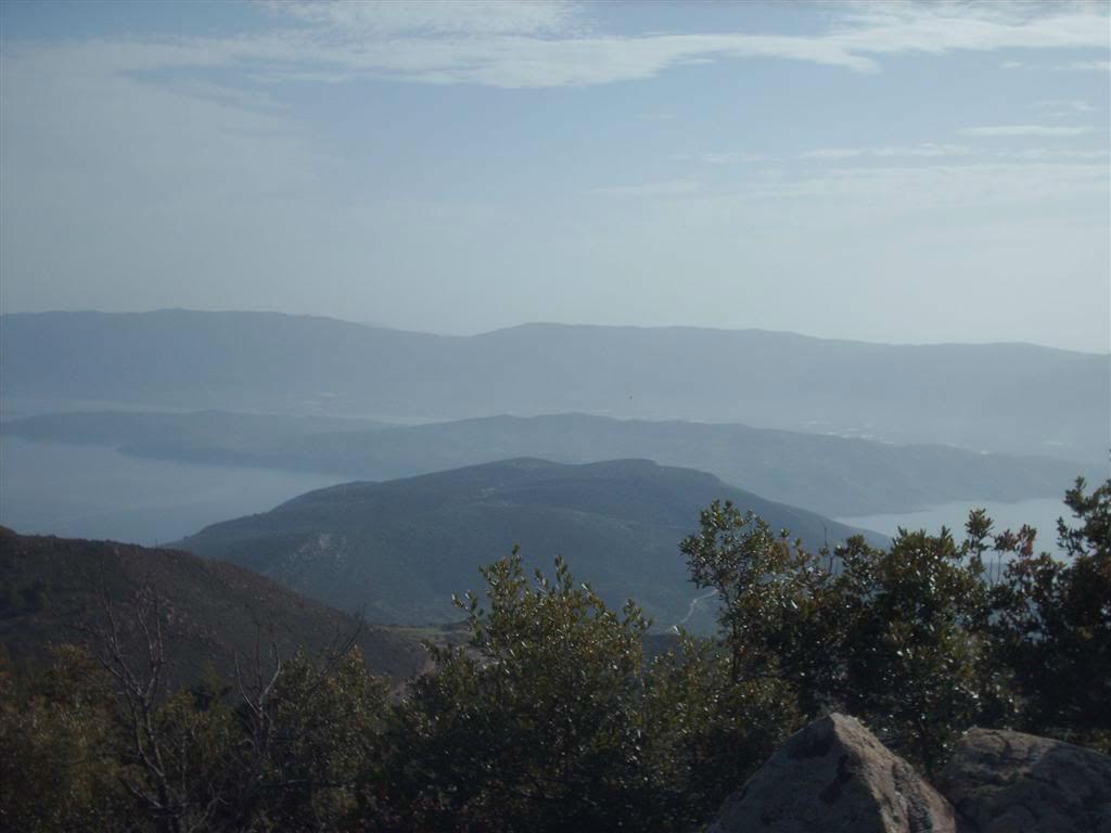
![]() The path continues at the west. We pass through three half-destroyed houses, reach Spatesi area at an altitude of 690 meters and continue through a pine forest to Makrilogo area at an altitude of 550 m.
The path continues at the west. We pass through three half-destroyed houses, reach Spatesi area at an altitude of 690 meters and continue through a pine forest to Makrilogo area at an altitude of 550 m.
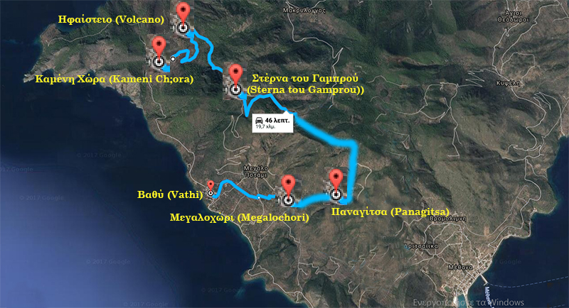
![]() On the way, on our left we meet a cistern, we pass it and after a while we see Agia Sotira and the "Sterna tou Gambrou" locaitons in front of us, after an hour of road, sometimes on the path and sometimes on an asphalt road.
On the way, on our left we meet a cistern, we pass it and after a while we see Agia Sotira and the "Sterna tou Gambrou" locaitons in front of us, after an hour of road, sometimes on the path and sometimes on an asphalt road.
![]() The settlement that existed near the "Sterna tou Gambrou" took this name and until 1834 it was a lively village and then abandoned. In this area there is the large volcano Malia Vgethi..
The settlement that existed near the "Sterna tou Gambrou" took this name and until 1834 it was a lively village and then abandoned. In this area there is the large volcano Malia Vgethi..
![]() From here, after another 3.4 km on the dirt road, we reach the point where the asphalt starts. You will find also a wooden shed. This is where the volcano trail begins.
From here, after another 3.4 km on the dirt road, we reach the point where the asphalt starts. You will find also a wooden shed. This is where the volcano trail begins.
![]() The path which is carved out of volcano lava is suffered from landslides and needs attention for your safety. After about 30 minutes we reach to the volcano crater. At the end of the path, we find an impressive cave formation that is often referred to as a "crater" without being one. The view from this point is unique!
The path which is carved out of volcano lava is suffered from landslides and needs attention for your safety. After about 30 minutes we reach to the volcano crater. At the end of the path, we find an impressive cave formation that is often referred to as a "crater" without being one. The view from this point is unique!
![]() At the foot of the volcano you will find built amphitheatrically the village of Kameni Chora, on a volcanic rock. The slope of the village is scattered with fossilized lava that is worth seeing.
At the foot of the volcano you will find built amphitheatrically the village of Kameni Chora, on a volcanic rock. The slope of the village is scattered with fossilized lava that is worth seeing.

4RTH TRAIL : VATHI - KAMENI CHORA - VOLCANO
DESCRIPTION: Difficulty rate: Medium ( 4.7 klm.)
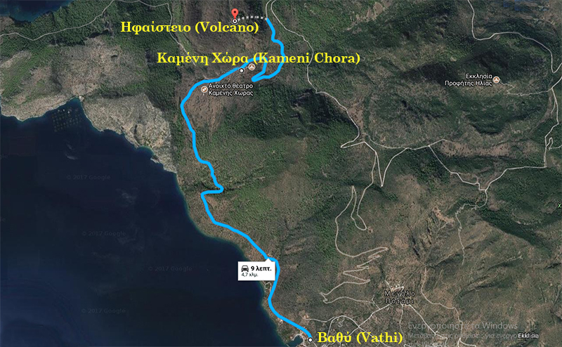
![]() Starting from Vathi, we take the road to the west, above the beach and after about an hour we meet in our right hand the Open Theater of Kameni Chora and then left the "Ioannou" tavern. Shortly afterwards, we reach the Volcano, which built amphitheatrically in the village of Kameni Chora, on a volcanic rock. The slope of the village is scattered by fossilized lava that is worth seeing.
Starting from Vathi, we take the road to the west, above the beach and after about an hour we meet in our right hand the Open Theater of Kameni Chora and then left the "Ioannou" tavern. Shortly afterwards, we reach the Volcano, which built amphitheatrically in the village of Kameni Chora, on a volcanic rock. The slope of the village is scattered by fossilized lava that is worth seeing.
![]() The path which is carved out of volcano lava is suffered from landslides and needs attention for your safety. After about 30 minutes we reach to the volcano crater. At the end of the path, we find an impressive cave formation that is often referred to as a "crater" without being one. The view from this point is unique!
The path which is carved out of volcano lava is suffered from landslides and needs attention for your safety. After about 30 minutes we reach to the volcano crater. At the end of the path, we find an impressive cave formation that is often referred to as a "crater" without being one. The view from this point is unique!
5TH TRAIL: VATHI - KAMENI CHORA - KRASOPANAGIA
DESCRIPTION: Difficulty rate: Difficult (4.3 klm.)
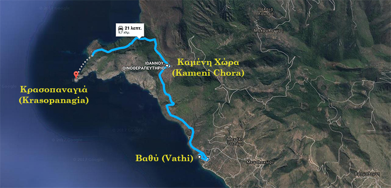
![]() Starting from Vathi, we take the road to the west, above the beach and after about an hour we meet in our right hand the Open Theater of Kameni Chora and then left the "Ioannou" tavern.
Starting from Vathi, we take the road to the west, above the beach and after about an hour we meet in our right hand the Open Theater of Kameni Chora and then left the "Ioannou" tavern.
![]() We start the route from the tavern "Ioannou". In front of the tavern there is a dirt road which we follow. We walk on the dirt road for about 2.5 klm, and we meet a branch on the road, we take the right branch which is a descending wider path.
We start the route from the tavern "Ioannou". In front of the tavern there is a dirt road which we follow. We walk on the dirt road for about 2.5 klm, and we meet a branch on the road, we take the right branch which is a descending wider path.
![]() After 55 meters the dirt road makes a right turn kai descends to the sea. At that point starts a descending path. This path at the start has got stairs made of small tree logs which are now very old. It is a path with signs.
After 55 meters the dirt road makes a right turn kai descends to the sea. At that point starts a descending path. This path at the start has got stairs made of small tree logs which are now very old. It is a path with signs.
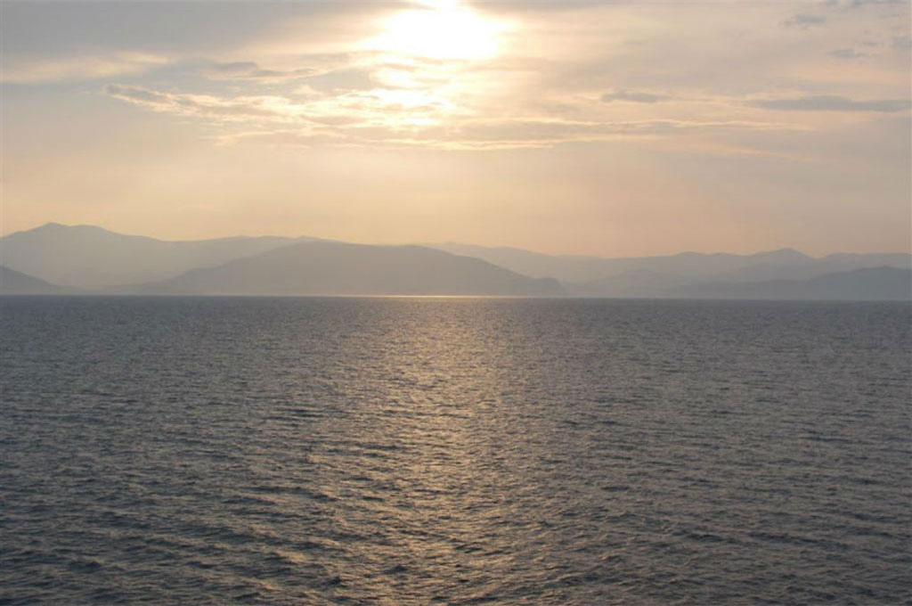
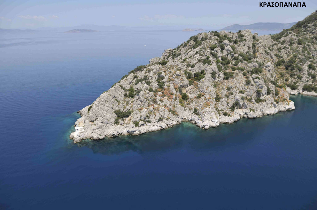
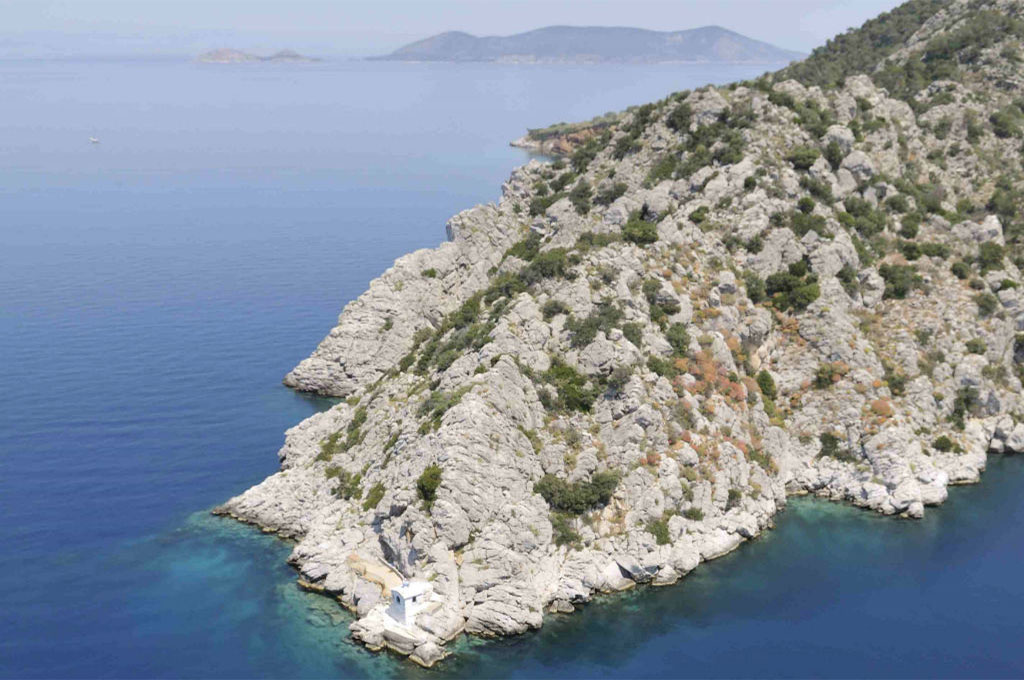
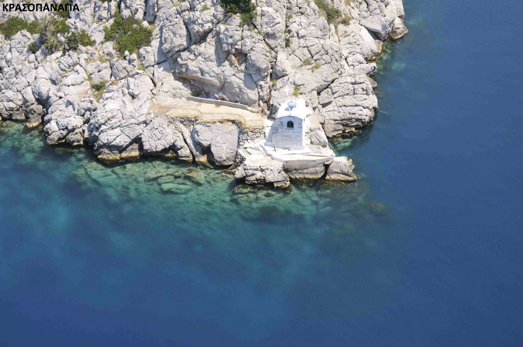
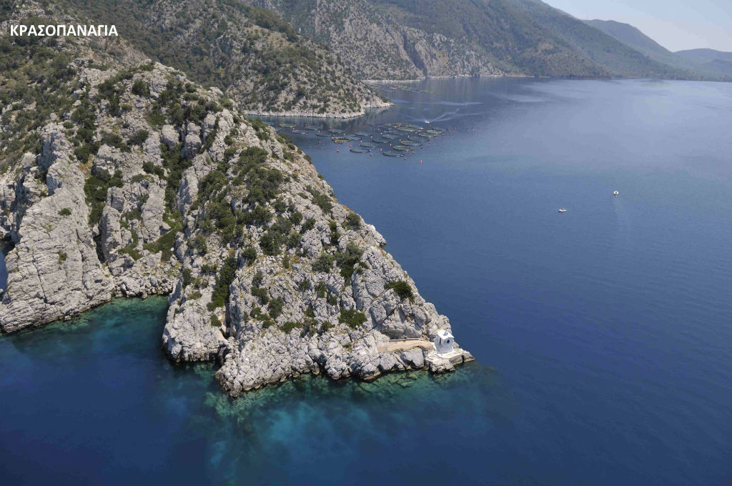
![]() After 300 meters the path seems to end in front of a small ravine which ends to the sea. At that point we continue the path straight down the ravine and so we reach Krasopanagia, after 450 meters. There is a small church there named Krasopanagia. It is a difficult trail.
After 300 meters the path seems to end in front of a small ravine which ends to the sea. At that point we continue the path straight down the ravine and so we reach Krasopanagia, after 450 meters. There is a small church there named Krasopanagia. It is a difficult trail.